Multivariate Standardized Drought Index (MSDI)
Multivariate Standardized Drought Index (MSDI) offers a multi-index drought monitoring framework for combining drought information from multiple variables (e.g., precipitation, soil moisture). A parametric [Hao and AghaKouchak, 2013] or a non-parametric copula [Hao and AghaKouchak, 2014] can be used to derive the MSDI from vectors of precipitation and soil moisture (or other climatic variables)
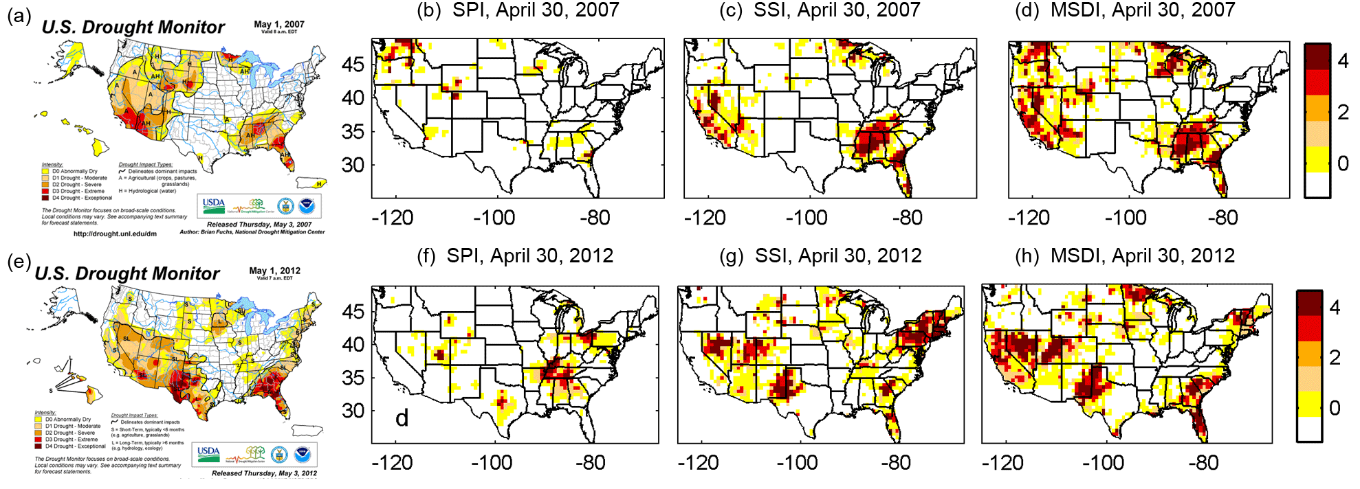
The below figure compares the MSDI with the Standardized Precipitation Index (SPI), Standardized Soil Moisture (SSI), and the United States Drought Monitor (USDM). The USDM provides composite maps of drought severity based on five categories of drought types: D0 (abnormally dry), D1 (moderate drought), D2 (severe drought), D3 (extreme drought), and D4 (exceptional drought). Here, the USDM is used as reference observation. For the sake of cross-comparison, the values of the SPI, SSI, and MSDI are converted to the D0 to D4 scale. The top and bottom rows show snapshots of the 2007, and 2012 United States Droughts. With respect to the spatial extent, the MSDI is in better agreement with the USDM data. It should be noted that the USDM involves many different input variables including subjective human inputs from local climatologists. The MSDI is an objective alternative that can be applied at the global scale (visit GIDMaPS).
 |
Source Code
Click Here to Download MSDI Source Code
MSDI Publications
Hao Z., AghaKouchak A., 2013, Multivariate Standardized Drought Index: A Parametric Multi-Index Model, Advances in Water Resources, 57, 12-18, doi: 10.1016/j.advwatres.2013.03.009. (pdf)
Hao Z., AghaKouchak A., 2014, A Nonparametric Multivariate Multi-Index Drought Monitoring Framework, Journal of Hydrometeorology, 15, 89-101, doi:10.1175/JHM-D-12-0160.1. (pdf)
Sponsors